
Assessing the contributing factors for animal mortality in coastal Ecuador
A GIS map using qGIS showing gps locations of hotspots collected by interns, GIS layers of contributing factors to animal road mortality and road segments to reveal hotspots of animal mortality
In addition to the Ceiba Foundation’s work in the forest reserve they have also been working on a long term project to better understand the dynamics of animal mortality on the coastal freeways and what the contributing factors are to the animal mortality hotspots. The goal of the project is to better understand where the hotspots are for future local construction to inform conservation managers where tunnels, barriers, or other mitigation tactics can be employed to reduce animal mortality by providing safe ways for wildlife to cross the highway.
Much of the data of animal mortality was collected by interns over time by driving up and down the target area and collecting gps and possible identification of every animal mortality event. ( I will spare you the images here. ) I hand digitized many of the layers using qGIS providing map layers for road proximity to forests, residential neighborhoods, shrimp farms, rivers, farms by type, proximity to ocean, elevation and road sinuosity. The highway was broken into sections, and we began to analyze what factors were affecting the hotspots of animal mortality.
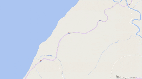
On the map above you can see the points on the highway where animal mortality events were recorded as well as the addition of the layers of possible contributing factors. The map then shows the hotspots of animal mortality on the freeway in the target area in red.
In the course of working on this project I wrote python scripts to assist me with some calculations. The first is a python script that calculates the number of points from a GIS point layer that fell in every polygon of a GIS polygon layer. For this project that meant iterating through every highway section and for each section counting the animal mortality events that occurred within it. You can check it out here. I wrote an additional python script that calculates what percentage one polygon layer overlaps another. This script was used to calculate the percentage of forested sections that overlap a buffer around the road segments, a measure of how close the forest is to the highway. You can check that one out here.
While the study continues at Ceiba, the hope is not only to create a better understanding of local ecology and animal mortality, but also create a model to better predict animal mortality in any location.